Where People Move, Brands Get Seen: Understanding East Malaysia’s Traffic Patterns

East Malaysia’s Key Roads: The Routes That Keep Cities and Communities Connected
October 27, 2026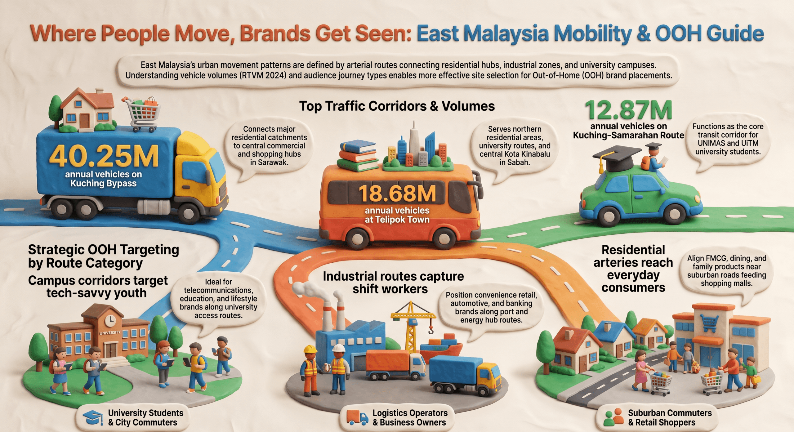
Traffic volume shows how many vehicles pass a point on a road, but not where they came from or where they are going. Across East Malaysia, roads connect universities, workplaces, residential neighbourhoods, shopping centres and industrial areas. Each generates its own pattern of movement — offering a useful perspective on how people interact with the places around them.
1. From Campus to City: Where Students and Workers Move
Tertiary education hubs in East Malaysia are primarily situated in dedicated satellite zones outside central business districts. Students constitute a highly mobile, tech-savvy demographic that relies heavily on daily transit corridors connecting residential rentals to campus gateways.
Kuching & Kota Samarahan (Sarawak)
Jalan Datuk Mohamad Musa / Kuching–Samarahan Expressway (Route SR108) connect southern Kuching with Universiti Malaysia Sarawak (UNIMAS) and Universiti Teknologi MARA (UiTM). RTVM 2024 records a high volume of 12.87 million vehicles per annum along this stretch. Students move along this arterial route daily for classes and gather at nearby lifestyle spots like Aiman Mall and Summer Mall for dining and groceries. On weekends, traffic flows back towards Kuching, where retail destinations such as Vivacity Megamall on Jalan Tun Jugah draw visitors.
Kota Kinabalu (Sabah)
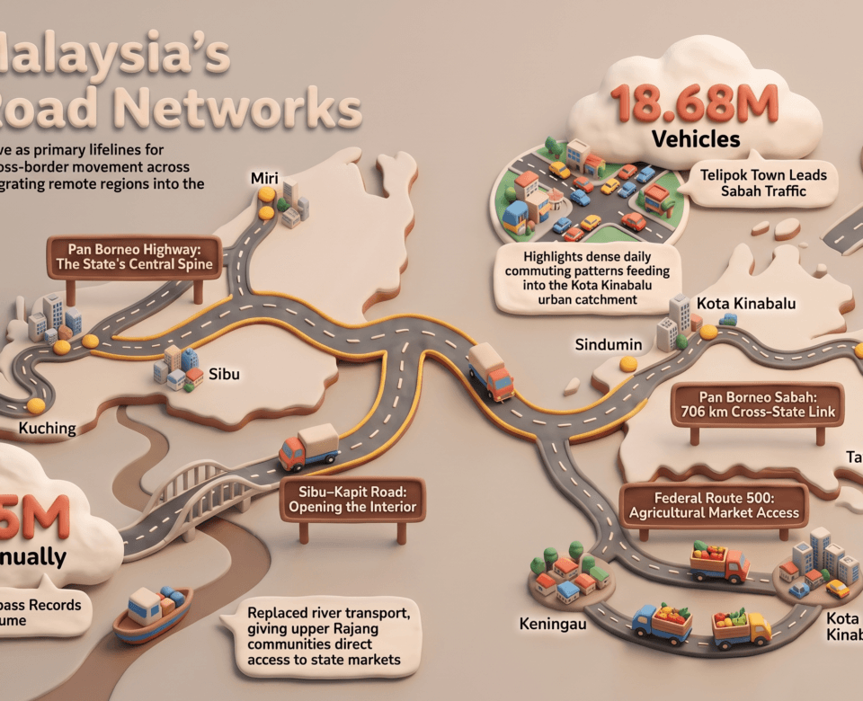
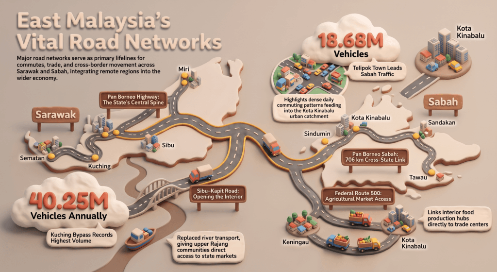
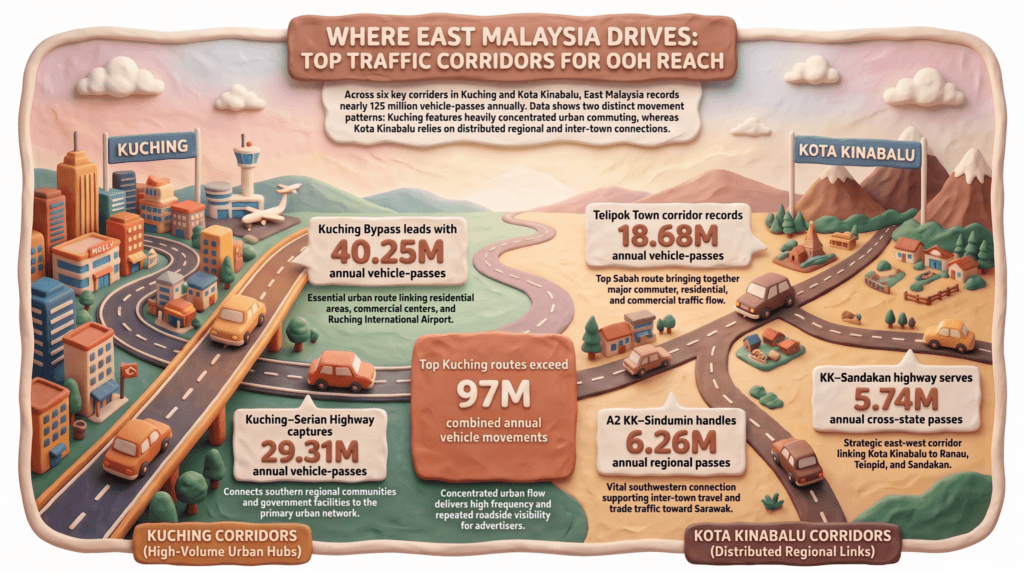
Jalan Sulaman & Jalan Tuaran Bypass (Route 1) linked the Sepanggar and Telipok housing areas with Universiti Malaysia Sabah (UMS), MARA Skills Institute (IKM), and downtown Kota Kinabalu. The Telipok Town section records 18.68 million vehicles a year. Students often visit 1Borneo Hypermall on Jalan Sulaman or Grand Merdeka Mall after class. On weekends, private vehicles and e-hailing cars travel down Jalan Tuaran toward downtown lifestyle centres such as Suria Sabah and Center Point Sabah.
2. Workers Movement & Industrial Port Corridors
The workforce in East Malaysia moves along defined transit lines that connect residential suburbs to industrial zones, offices, and ports. In some cities, campuses, industrial areas and housing developments sit outside the main centre, so student and worker journeys overlap on the same roads.
Bintulu (Energy & Heavy Industrial Engine)
Jalan Tanjung Kidurong (Route SR405) carries about 11.58 million vehicles a year. It is a main route for shift workers traveling to Bintulu Port, PETRONAS LNG complexes, and Samalaju Industrial Park. Workers on these routes may stop at shoplots in Parkcity Commerce Square and Medan Jaya for meals, banking, and convenience retail.
Sibu (Central Logistics & Trade Hub)
The Rejang Port Access Road, Jalan Kampung Nyabor / Jalan Lau King Howe (Route SR304) carries 13.65 million vehicles a year. They link Sibu’s city center to riverine shipping terminals and industrial yards. During the day, the corridor is used by business owners, traders, and logistics operators, some of whom visit the local coffee shops (kopitiams) and bank branches along Jalan Kampung Nyabor.
3. Residential and Lifestyle Movement: From Daily Errands to Weekend Outings
People’s journeys do not end when they leave work or campus. Residential areas generate movement towards supermarkets, shopping centres, restaurants, clinics, schools and recreational spaces.
Kuching: Residential Catchments and Shopping Destinations
Several established and newer neighbourhoods, including Green Heights, Stampin, Tabuan Heights, Tabuan Jaya, BDC and Matang Jaya, are connected to the city’s commercial centres by a network of main roads.
Several roads help connect these catchments with the wider city:
- Kuching Bypass / Jalan Tun Razak / Jalan Datuk Marican Salleh connects different parts of the urban network.
- Jalan Tun Jugah and Jalan Stutong Baru serve as important urban connections and commercial catchments.
- Jalan Wan Alwi provides access to Vivacity Megamall and surrounding residential and commercial areas.
- Jalan Simpang Tiga connects education, accommodation, commercial activity and The Spring Shopping Mall.
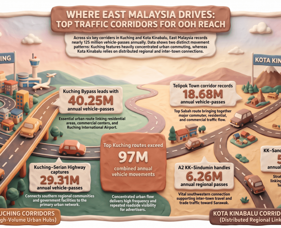
RTVM 2024 records about 40.25 million vehicles annually on Kuching Bypass (Federal Route 801: Jln Dato Bandar Mustapha / Jln Tun Jugah / Jln Tun Razak) and 11.99 million on Jalan Stutong Baru. These figures show the scale of traffic at each counting point. They do not show how many of those vehicles are carrying shoppers or residents from any particular neighbourhood.
Kota Kinabalu: City-Centre Retail and Suburban Connections
Kota Kinabalu combines city-centre retail with surrounding residential areas. Jalan Tun Fuad Stephens serves Suria Sabah in the city centre, while Jalan Lintas and the surrounding road connect different urban areas and commercial destinations. To the south, Jalan Penampang and Penampang Bypass connect the city with Penampang. Jalan Tuaran and Tuaran Bypass serve the northern residential areas. Suria Sabah, Centre Point Sabah and Imago Shopping Mall are among the city’s main retail and leisure destinations, and supermarkets and smaller commercial centres serve the neighbourhoods around them.
The RTVM 2024 dataset records 18.68 million vehicles annually at Telipok Town, associated with Jalan Tuaran, Jalan Lintas and Tuaran Bypass. This provides a useful reference point for understanding recorded movement along the northern Kota Kinabalu network.
Sandakan and Tawau: Connecting Town Centres with Daily Needs
In Sandakan, Jalan Labuk and Jalan Lintas Labuk connect the urban area with surrounding communities and with destinations such as Sepilok and Gum-Gum. In Tawau, Jalan Apas serves residential and outer-town areas, while Jalan Kuhara provides access to residential areas and commercial destinations. Routes outside the central business district carry everyday trips between homes, local businesses and the town centre.
Miri and Sibu: Different Commercial and Lifestyle Catchments
In Miri, Bintang Megamall and Boulevard Shopping Complex serve retail, dining and entertainment needs, and a Curtin University shuttle route links Senadin with these destinations. In Sibu, Sibu Central Market is a daily destination for shoppers and traders. It sits opposite the express-boat passenger terminal, bringing market activity together with the town’s wider transport network.
3. Government and Public-Service Movement
Government centres can also shape movement in a city where several are concentrated. In Kota Kinabalu, Menara Kinabalu in Teluk Likas, along Jalan Sulaman, serves as Sabah’s state administrative centre and houses numerous government departments and agencies. In Kuching, Wisma Bapa Malaysia in Petra Jaya houses key Sarawak state offices, including the Office of the Premier and the State Secretary’s Office. The roads serving these areas connect offices, residential areas and the city. Such destinations may be relevant when considering public-service messages, health campaigns, road-safety communications and government announcements.
Daily Traffic Rhythms
Traffic activity can also vary throughout the day.
- Morning: typically shaped by commuting and school-related trips between residential areas and workplaces, campuses and city centres.
- Midday: movement often centres on errands, business visits, meals and school pick-ups, particularly around commercial areas.
- Late afternoon and evening: returning commuters share the roads with people heading to shops, restaurants and leisure destinations.
- Weekends and public holidays: show different patterns from weekday commuting, as movement shifts toward retail, dining and recreation.
4. What These Patterns Mean for OOH Planning
Traffic data is a useful starting point for understanding how a city works and vehicle counts show how many vehicles pass a point over a year.
For example, retail and FMCG campaigns may be relevant to roads serving residential and shopping catchments. Automotive, banking and telecommunications brands may consider major commuter routes, while education-related services may examine the roads connecting campuses with the surrounding city.
The patterns described in this article are general observations about how roads connect places. A robust OOH assessment should combine traffic volume, surrounding land use, journey purpose, direction of travel, viewing distance, obstructions and the actual visibility of the media site. Traffic data offers useful context, but it cannot independently establish unique reach or advertising performance.
Understanding where people travel helps explain how East Malaysia’s cities function and how roads connect homes, workplaces, schools and shops. Looking at those connections alongside traffic volume gives a fuller picture of everyday life across Sabah and Sarawak.
Source: Road Traffic Volume Malaysia (RTVM) 2024 | DMDC Media analysis of East Malaysia road traffic data