
Where East Malaysia Drives: The Top 3 Traffic Corridors Powering OOH Reach in KK and Kuching.

Rainforest World Music Festival (RWMF): WHERE CULTURE MEETS MUSIC!
June 5, 2025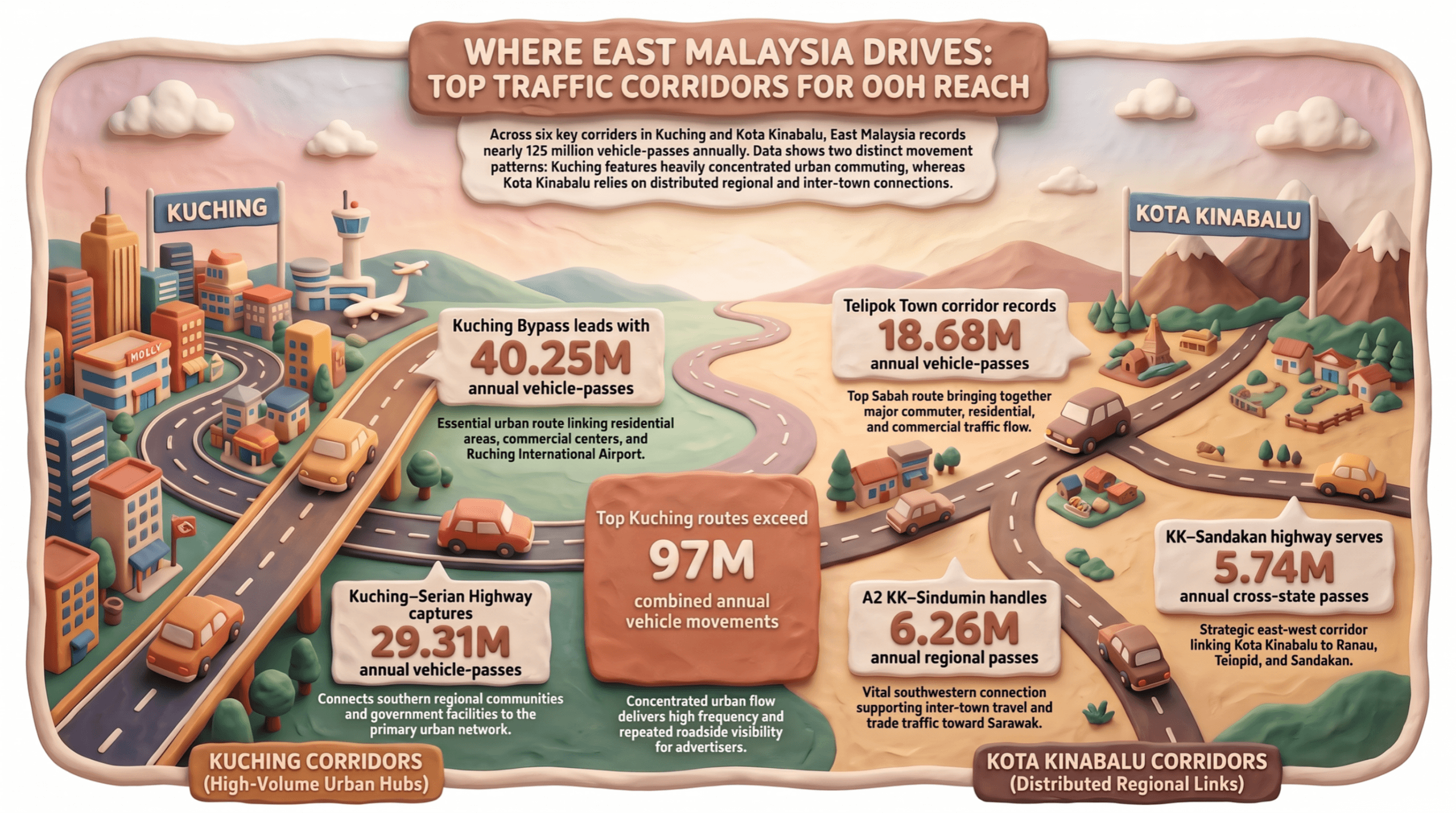
Where people move, cities connect — and for Out-of-Home (OOH) media, understanding that movement starts with understanding the roads.
Based on RTVM 2024 traffic volume data compiled in our East Malaysia road traffic analysis, looking specifically at the top three traffic-volume locations in Kuching and the top three in Kota Kinabalu. Across these six corridors alone, East Malaysia records close to 125 million vehicle-passes a year — a scale that puts them at the centre of any OOH plan for Sabah and Sarawak.
📍 KUCHING: THE REGION’S HIGHEST TRAFFIC MOVEMENT
1. Kuching Bypass
Kuching Bypass | Jalan Tun Razak / Jalan Datuk Marican Salleh
🚗 40.25M vehicles per annum
📈 3.35M vehicles per month
Kuching Bypass represents a major movement route within Kuching.
The road is a major part of Kuching’s urban network, linking multiple parts of the city and providing connections towards areas such as Stampin, Pending, the city centre, Kota Samarahan and Kuching International Airport. Its intersections also connect motorists to shopping, residential and commercial areas along the wider network.
That helps explain why its traffic volume is so substantial: this is not only a through-route. It supports day-to-day urban movement, including commuting, access to commercial areas, airport journeys and movement between different parts of Kuching.
For OOH planning, routes with this level of recurring movement provide a strong foundation for considering frequency, continuity and repeated roadside visibility.
2. Kuching–Serian
Kuching–Serian Highway | Route 1, Station SR106
🚗 29.31M vehicles per annum
📈 2.44M vehicles per month
The Kuching–Serian route records the second-highest traffic volume among the selected Kuching roads.
Its importance comes from its role as a major connection between Kuching and the surrounding southern areas, creating a substantial flow of vehicles entering, leaving and moving through the wider Kuching area.
It connects Kuching with Siburan, Serian and surrounding communities, supporting a mix of daily commuting, regional travel, business and access to services. Government facilities, including the Padawan district police headquarters and JPJ facilities, are located along the Kuching–Serian road, illustrating the route’s role in connecting communities and services.
For people travelling between Kuching and the surrounding southern communities, this makes the route relevant not only for commuting, but also for regional business, services and longer-distance travel.
3. Jalan Kuching
Pan Borneo Highway / Jalan Kuching–Serian
🚗 27.71M vehicles annually
📈 2.31M vehicles monthly
The third-highest traffic location in Kuching records almost 28 million vehicles annually.
This segment sits within the broader Kuching–Serian road network and contributes to movement between the city and surrounding areas. The wider route serves places including Siburan and Serian, where government and community facilities are located along the road.
Together, these three Kuching locations record more than 97 million vehicle movements annually based on the RTVM data.
📍 KOTA KINABALU: KEY ROUTES SUPPORTING MOVEMENT ACROSS SABAH
1. Telipok Town — 18.68 million vehicles annually
Telipok Town | Jalan Tuaran / Jalan Lintas / Jalan Tuaran Bypass
📍 Kota Kinabalu, Sabah
🚗 18.68M vehicles annum
📈 1.56M vehicles monthly
On the Sabah side, Telipok Town records the highest traffic volume in Kota Kinabalu within the dataset.
The route supports movement between Kota Kinabalu, Telipok and surrounding areas, bringing together residential, commuter and commercial traffic.
2. A2, KK / Sindumin
0.5 km Mesapol–Sipitang
🚗6.26M vehicle per annually
📈522.03K vehicles monthly
The A2 KK/Sindumin route represents a different type of movement from the urban roads around Kota Kinabalu.
For road users, this is an important southwestern regional connection, Federal Route 1 connects Kota Kinabalu through Papar, Beaufort and Sipitang to Sindumin, where the route continues towards Sarawak.
The route therefore supports a mix of inter-town travel, business movement, local trips and longer-distance journeys.
3. KK–Sandakan
25 km from Sandakan towards KK — Gum-Gum
🚗 5.74M vehicles per annum
📈 478.11K vehicles per month
The third selected Sabah route is the Kota Kinabalu–Sandakan road, measured at the Gum-Gum section.
This route forms part of one of Sabah’s major west–east road connections, linking Kota Kinabalu with Ranau, Telupid and Sandakan.
What does the data tell us about OOH?
The six locations show two different movement patterns across East Malaysia.
Kuching’s highest-volume roads are strongly urban and city-connected, with the top three locations each exceeding 27 million vehicles annually.
In Kota Kinabalu’s wider network, traffic is distributed across routes that serve urban movement as well as connections to northern, southern and east-coast Sabah.
The traffic numbers reveal something important:
📍 Where people are moving
🚗 How frequently vehicles pass through an area
🏙️ Which urban and regional destinations are connected
For media planners, understanding East Malaysia’s road movement helps us look at OOH from a wider perspective — not just where a billboard stands, but where people travel, connect and move through their everyday journeys.
Source: Road Traffic Volume Malaysia (RTVM) 2024 | DMDC Media analysis of East Malaysia road traffic data


